

InfraPatrol®
Advancing Infrastructure Safety and Security Through Advanced Digital Technology
Advancing Infrastructure Safety and Security Through Advanced Digital Technology
InfraPatrol® advances infrastructure safety through digital technology. AI automatically detects damage from footage captured by moving vehicles and instantly shares findings via the cloud, reducing time spent on field data collection and report preparation to achieve more advanced and efficient road patrol operations.

- Patent Registration Nos.5901825, 5911623, 5948465, 6721915, 6731667
- Inspection Support Technology Performance Catalog No.PA020003-V0025
- NETIS Registration No.CB-240005-A
- River Inspection Technology Catalog:Measurement-12
Challenges InfraPatrol®
Can Solve
- Information sharing between the field and the office is time-consuming
- Risk of overlooking damage
- Managing inspection data is complicated
- Report preparation requires significant man-hours
Technology & Product Overview
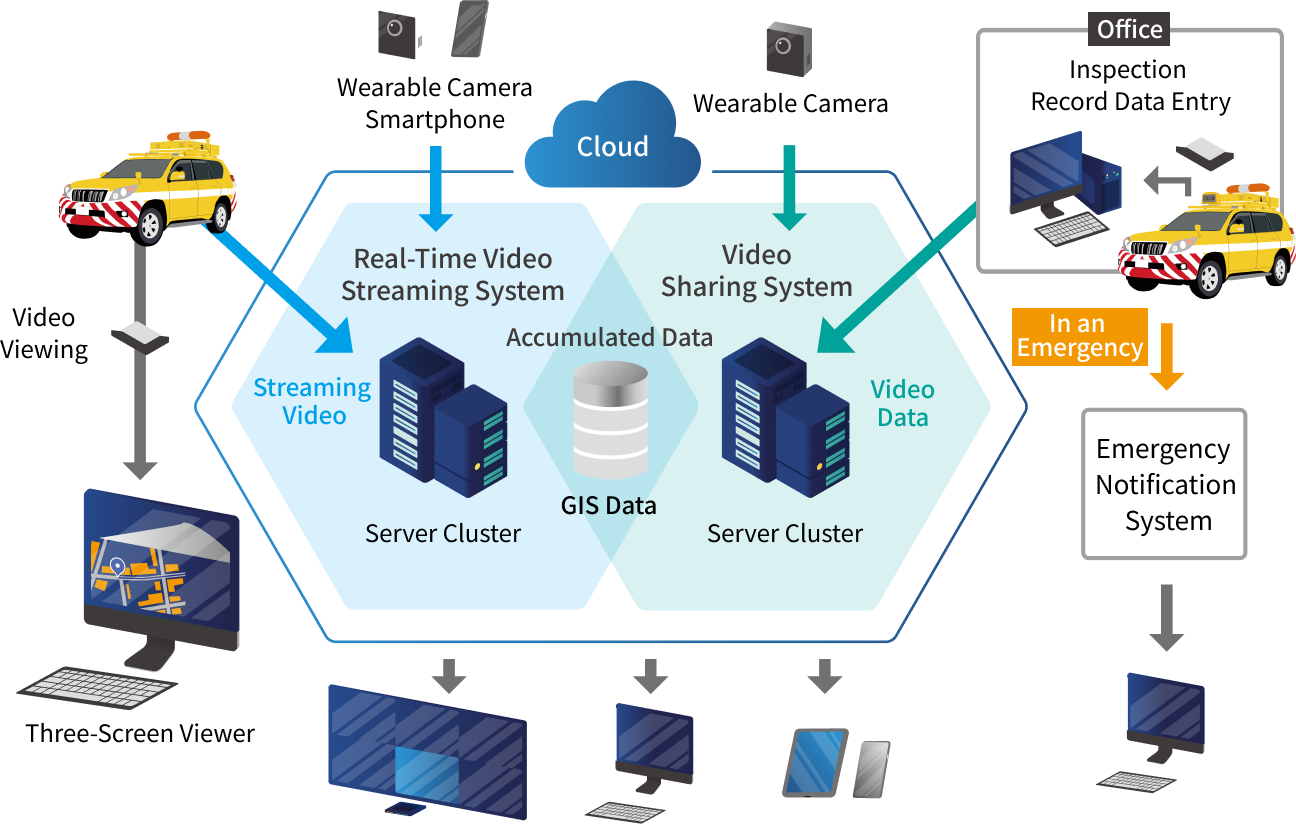
InfraPatrol® leverages video data stored in the cloud to perform AI-based automatic damage detection. Field data including video footage, location information, and work details captured from moving vehicles can be shared on a GIS platform via the cloud. This significantly reduces time spent on field data collection and report preparation, improving operational efficiency.
System Overview
-
1Information Visualization
Video footage from vehicle-mounted cameras, smartphones, and wearable cameras is stored in the cloud. Both live footage and archived recordings can be quickly searched and reviewed by desired location, time, and situation.
-
2Accurate Situation Assessment and Remote On-Site Support
Real-time situational awareness is possible via a web browser in the office without visiting the site, enabling accurate situational assessment. Even in situations requiring complex judgment—such as upon discovery of damage or during a disaster—information can be rapidly shared among relevant organizations to discuss appropriate responses.
-
3Automatic Generation of Reports and Driver Logs
Driver logs are automatically generated from vehicle activity history. Location data and video footage can also be sent from the field with a single press of a remote control button, enabling easy report creation at the office and reducing overall work hours.
-
4Maintenance Work Management Function
Simple smartphone operation displays the real-time status of road maintenance and snow removal operations on a map. The system also supports management of work routes and progress, vehicle deployment during snow and ice response, and checking brine plant inventory, enabling optimization of operations that were previously reliant on individual experience.
-
5AI-Based Damage Detection
Collected video footage is analyzed by AI to automatically detect and map pavement damage such as potholes and cracks.
Detailed Functions
-
Preventing Oversights Through High-Precision AI-Based Automatic Detection
AI automatically analyzes and extracts pavement damage—such as cracks and potholes—from footage captured by patrol vehicle cameras. With detection accuracy surpassing that of human inspectors, this not only improves inspection efficiency but also helps prevent serious damage from being overlooked and reduces the risk of unexpected accidents.
-

Automatic extraction from footage captured by InfraPatrol®
-

Damage extracted as still images
-
-
Real-Time Information Sharing Between Field and Office (Visualization)
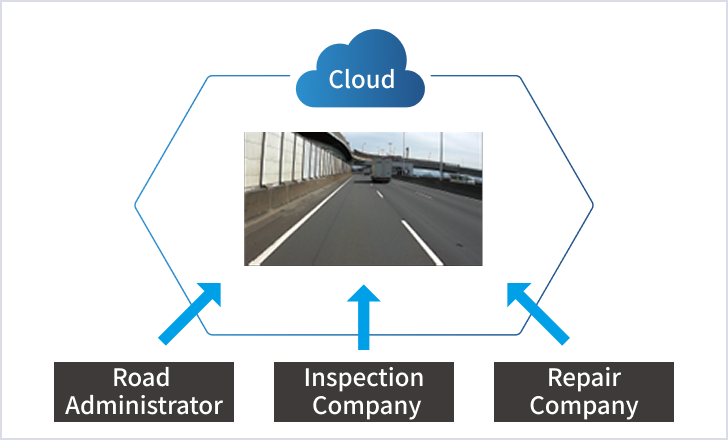
Real-time video from smartphones, wearable cameras, and vehicle-mounted cameras—along with location data and work content—is shared on a GIS platform via the cloud. This enables the office and relevant organizations (administrators, inspection companies, repair companies, etc.) to visually confirm field conditions on a map, facilitating rapid and accurate situational assessment and response even during disasters or emergencies.
-
Reducing Administrative Work Time Including Report Preparation
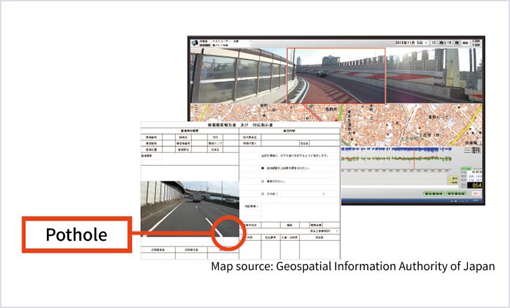
A dedicated system automates and supports the preparation of various reports—including damage reports and driver logs—from data accumulated during inspections. By reducing the time and effort previously spent on document creation and data entry, which had been a major burden in the office, work hours are shortened and the system makes a significant contribution to work-style reform, including reduced overtime.
-
Reducing Repair Costs by Tracking Changes Over Time
Data transmitted from the field and accumulated over time can be managed in chronological order. By comparing past data with current conditions, the progression of damage to road accessories and pavement can be accurately tracked, enabling planned maintenance and management that suppresses the need for large-scale and costly repairs.
